Author Archives: Andrew and Meghan

Camping in Polihale State Park (South-West Kauai)

IMG_9939

Sunset pineapples are the best type of pineapple.

We live for the untouched, hidden, secluded, end of the road type of places. Sometimes it’s not possible to find those places. Sometimes it’s too hard to get to them. Sometimes it’s just hard enough that it keeps people away and that’s the sweet spot. Polihale is one of those sweet spots. Located at the end of the road on the South coast, next to Na Pali coast, down a beat up road, Polihale State Park has 17 miles of beach, day use facilities, and camping. The water is typically a bit rougher here, although Queen’s Pond is a protected area that is more “docile” and many people swim there.  Most people visiting Kauai want to be pampered and not deal with camping equipment (rental or other) so Polihale makes a great getaway spot for seclusion and reflection.

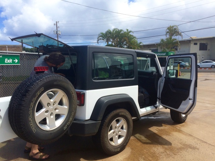
We had read and heard a lot of different things about Polihale State Park. For example, we read that it’s accessed down a dirt road that is sometimes maintained by the park service and sometimes left alone and unkempt. We read in some books that 4WD vehicles are a must, while others claim that any car can go. Through these varying recounts of Polihale, the one piece of information that did seem to be consistent was that many car rental companies will basically void insurance if you go out to Polihale and get stuck or need a tow. For this reason, we’re going to say check your rental agreements and if you really want to go out here, rent a 4WD vehicle.

To get there is fairly straightforward (that’s what you get on a small island with one main road)! To get there from Lihue Airport for example, you get onto Highway 50 and drive west. In about 34.5 miles (after you’ve passed Waimea Canyon turn-outs and signs for the Pacific Missile Range Facility) you curve right onto Kao Road which quickly turns into Kiko Road. After 0.2 miles, you’ll see Lower Saki Mana Road on your left (across from a gate with a graffiti sign and a Private Property sign). There’s also a sign a few feet before the road (on the right side) with an arrow just in case you can’t find it.

It’s at this point that the dirt road adventure begins. We drove out in the end of August and it was very dry, but I suspect that’s not always the case, so check your weather forecasts before you go. I’ve heard at times, it can flood over and make it a mucky, muddy, mess. The drive is about 4 miles out to the end of the dirt road… you basically end up on the beach. As an aside, while above we noted that 4WD is helpful, we will also backtrack here and say that there were all sorts of cars out there- jeeps, vans, trucks, mustangs even! Just be careful. After a couple miles of bouncing and trouncing you arrive at a giant Monkey Pod Tree in the middle of the road (picture below). The left “Y” will take you to Queen’s Pond, a supposedly docile and protected area for swimming in the Polihale State Park area. I say ‘supposedly’ because we didn’t really find a “docile” area… more of choppy, but not too choppy, all along the Polihale Coast. That didn’t stop us from swimming at Queen’s Pond, nor at Polihale proper. If you do decide to swim, be very careful, don’t go out too far, and assess before you go in. We went in because it didn’t look too bad. However, if the waves are big don’t risk it. This is a very unpopulated area so you’re on your own.

If you continue to the right of the Monkey Pod Tree, you enter the camping and day use area. Camping permits can be purchased online through the Hawaii Department of Land and Natural Resources. Permits cost $18 per tent (non-resident) and you may camp for up to 5 nights (nightly capacity is 60). Note that the link to the camping page (hyperlinked above) states $12/person. When you click on the box to be taken to the permit purchashing site, you will note that the actual cost is $18/non-resident tent. Anyway, after the Monkey Pod Tree, you will pass some picnic tables and then as you continue down the sand road, you will notice four “sand driveways” is what I’ll call them. Each one is a “camping area”. They each have a small sign that says “Camping Area XX” (1-4). There also some pull outs that don’t have camping signs. If you continue on to the end of the road, you’ll see a few pavilions and the beach. While we saw one truck drive onto the beach, no one else did. To make life easier, don’t drive on the beach. You’ll need an air pump and a pressure gauge at a minimum and don’t forget that if you get stuck you’re basically screwed.

IMG_6597

Sometimes even small cars can make it out here!

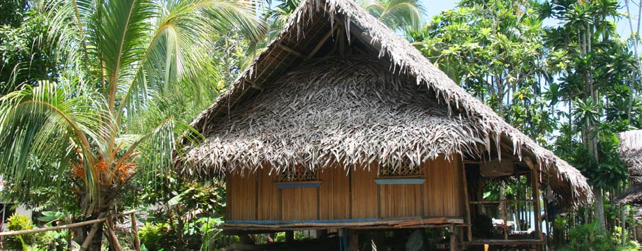
Anyway, if you are camping, you can pull into any of the camping areas. You may be discouraged if you see a car parked and a tent out in front, but don’t be. The camping area is not just the area directly in front of the car parking. It is much larger. We stayed at camping area #3 (picture of parking above) and couldn’t be happier. We parked in the designated area (where there was a tent set up about 10 feet ahead of us). We saw a sort of opening to the left in the trees and walked that way only to wind around and find (in our opinion) the perfect camping spot. We were tucked away from the cars and other campers with our own beach entry point. We could literally see the ocean from our tent and yet we were protected within the trees. Awesome.

We ended up spending two nights in Polihale and in the end, I think we both would have spent 20 more there if we didn’t want to see the rest of the island! It was so relaxing. There was some cell service (in and out), no hustle and bustle… just mandatory relaxation. After the first night we picked up beach chairs so we could spend a few hours out on the beach the next afternoon. When we did, we saw two young friends (the ones with the truck) and some fishing poles… and maybe one other couple. As an aside, it’s important to note the size of the dunes here… easily 100 feet. There’s no easy way down or up– just you and your feet. Going down the dunes is fine, but back up is tiring- just be aware before you embark. Another note is that the sand gets really really hot (especially at mid-day). A few sites and guidebooks we read said that your best bet is to wear hiking sucks (no shoes) to walk on the beach… in fact some people even reported getting blisters from barefooting it. We went later in the day and without shoes and it was hot but manageable… but I’d heed the warnings- always better not to deal with foot blisters and put on some socks! The reason you don’t wear shoes is because you are likely to get sand stuck in your shoes which will be uncomfortable and hot.

We swam for a while in the water, just bobbing along and then eventually sat and dried out… at one point we heard a helicopter and figured it was a tour… Polihale is located at the start of the Na Pali coast, so many tours- boating, kayaking, helicopter, etc. go down this way. However, we noticed the bright red helicopter circling in and out of the same mountain– then it landed somewhere behind Polihale before taking off again, this time with a really long cord with some sort of windsock looking thing tied to the end. After disappearing into a canyon/mountain fold, the helicopter reappeared with a person(!) attached to the end of the long cord! They eventually landed again somewhere behind Polihale before taking off back down the coast the way the helicopter originally came. The verdict- must have been a practice rescue exercise. Still cool and interesting to watch!

Other things to note about Polihale: each camping area is a few feet to restrooms and an outdoor shower. The bathrooms are simple, but they’re bathrooms! Each has two stalls and toilet paper as well as a sink (but no soap). There is also a freshwater faucet by the restrooms to fill up on water. In addition, there is a trash can and recycling bin (the word “recycle” is painted on one of the two cans) by each camping area. Open fires are not allowed, but you can have a grill. We opted to lay out our tent rainfly on the beach and eat pineapple and guava rolls while watching the sunset. Now that’s living!

As another aside for this area, if you take the dirt road back out to the main paved road and turn left (not towards Lihue), you will eventually dead-end (whether you end up weaving left or right) at some giant security gates. What are they?! Oh they’re just gates blocking off mountains that have caves with ammunition and other military weapons hidden and guarded in them. Crazy, right? Seriously though, there are tons of signs and cameras and what not– so don’t go snooping, but you can drive up and turn around if you’re so inclined. You can’t see anything except the signs and gates by the way… unless you run into a raucous herd of goats running all of the place (as we did!).

Two thumbs up and 5-stars to Polihale State Park! If you get a chance to go camping out here, do it! If you don’t want to lug your camping stuff with you on the plane, there are a few rental places around the island such as Kayak Kauai or Kauai Camper Rental or really a whole slew of them… these two I have heard mention in books before for what it’s worth. That’s all for now- we’ll see you next time!

IMG_6563

Categories: Camping, Hawaii, Unique Places to Stay | Tags: , , , , , , , , , , , , , , , , , | Leave a comment

Short Hike in Koke’e: Pihea Trail

After an evening of camping in Koke’e State Park, we woke up early, along with the roosters crowing around 5:45AM or so. This was partly due to jet-lag, partly due to excitement of vacation, and partly due to wild crowing roosters! Just so you’re aware, there are wild roosters and chickens all over the island, so if you do happen to have a weird fear of them (Alektorophobia… apparently it’s pretty common), then don’t come to Kauai. Or stay on the manicured resort properties… and even then, you still may see them. Apparently, Hurricane Iniki tore through in 1992, destroying (among many other things) chicken coops. The result was a prolific number of wild roosters and chickens which can be found on all parts of the island. Regardless of our early up and at ’em causation, we packed up our tent and dined on guava rolls, peanut butter, and fruit, before heading up the rode from camp towards the Pu’u O Kila Lookout. As mentioned in a previous post, Pu’u O Kila Lookout is the end of the line on this rode.

There were originally plans to connect the highway here so that a road would circle the entirety of Kauai, but those plans fell through for various reasons and as rumors have it, the locals are happy with that failure. While a road connecting the entire island would be easier for tourists to get around, it would also take away some of the beauty of the Na Pali and Koke’e areas that are more wild, scenic, and less accessible areas of the island.

IMG_6459

The Pihea Overlook trail starts at the Pu’u O Kila Lookout, where a sign reads, “One of the wettest spots on earth”. The picture above (and throughout this post) are a testament to that sign- we had overcast and drizzly weather the whole time we hiked (although there did seem to be some efforts by the sun to try and pierce those clouds, albeit, unsuccessfully). To access the trail, park in the lot by the Pu’u O Kila Lookout. It’s hard to miss, as it’s the very end of the road. As everywhere, use common sense, and don’t leave valuables out in the open in your car while you’re hiking. There is a bathroom there, but you’d be wise to fill up on water before you get here. At the end of the lot there is a ramp leading up to the overlook as well as a sign for Pihea Trail. Walk up the ramp and check out the view (if there is one) and that’s where you will see the sign proclaiming how wet it is here. The elevation is around 4000 feet or so. Before you get up to this “vista” (which is gorgeous when there are clear skies– see below as a reminder of what we saw the day before)…

IMG_6456

View from the previous day.

you will see a sign with the distances to Pihea Overlook (about a mile, but we clocked it closer to 1.5, since we ended up turning around a mile in due to trail condition), Alakai Crossing, and Awaikoi Camp. Alakai Swamp Trail is another great trail that is supposed to be fantastic for birding. Anyway, you will see the sign and directly to the left of it is what appears to be a little trail leading off into the ferns. This is a false trail. You will noticed a little arrow has been etched into the sign (circled in our picture) which points left. Skip this “faux” trail and keep going as the arrow indicates to get to the Pihea Trail.

IMG_6460

Take note of the etched in arrow pointing you the right direction.

The trail runs you across the ridge, up and down, through Ohi’a trees, ferns, Koas, and other native plants. There are also a few boardwalk areas. Generally though, the trail, especially after rain, is super muddy and slippery. Make sure you take your time and even if it’s overcast, enjoy the serenity. When we went, there had been some rain the previous night, which I think exacerbated the slippery and hazardous nature of the trail. I have seen plenty of other pictures showing the trail much drier… so just make sure you are aware of your surroundings. If you do happen to have clear skies for this hike, you will be greeted with a huge number of panoramic views of the valley and not so far off Na Pali coast. There are plenty of boulders to climb up on the sides of the trail in different areas to get a better look, but be aware of your feet- you could easily fall to your demise.

Also be aware of spiders as you hike, especially if you’re hiking early in the morning. I read a few articles about crab spiders which were introduced to the island to try and control a bug problem on crops (it failed) and the result is a large number of small and annoying spiders that will apparently bite you and irritate your skin (no lasting harm). We talked to one local who said the best way to avoid them is to hike with a stick that you can just wave in front of you as you hike. While we were fortunate not to have any run-ins with crab spiders, we did find a gorgeous web that was outlined with water droplets… which we wouldn’t have been able to find if we hadn’t taken our time. About a mile on down the trail (there are small metal mile markers on the right-hand side of the trail as you hike towards the overlook), we realized that conditions were just getting worse and worse. On top of that, we ran into a couple that told us they had fallen three times and getting to the overlook was pretty impossible. So, after hiking a few more minutes, we tucked our tails, called it a win, and turned around.

IMG_9816

Water droplet spider web

On the way back to the trailhead, we ran into maybe 2 other people- one hoping to make it to Alakai Swamp (endemic bird species that can’t be found anywhere else in the world) and another who’s husband had ditched her already because of the deteriorating path. She hiked a few minutes more and then we saw her again as she zipped back up the trail. The hike back to the trailhead may have been a bit slower than the way out because it was mostly uphill and there were several ways to ascend the different rocky areas, but it was great to be outside, the temperature was mild, and the feeling was serene after being cooped up on a plane for the day prior and coming from a summer of work! All in all, we had a very enjoyable hike and would definitely do it again. While it would have been perhaps more rewarding if the weather were calmer and clearer, it was still a nice morning exercise bout.

IMG_6468

The overcast weather gave the trail an eery feel 🙂

Insider Tips: Bring water with you; wear hiking boots (sneakers won’t cut it if there’s any mud or it rained recently); you gain about 250 feet on Pihea Trail (about 100 or so going to the Pihea overlook). It might be helpful to bring a long-sleeved shirt with you if you go early because it was chilly. In addition, to avoid the crowds, go early. We starting hiking around 8AM and stopped to meditate in a big clearing on top of the ridge a little ways down the trail. When we returned to the trailhead, maybe 1.5 hours later, the parking lot (which had one other car in it when we arrived) was full of cars, with people getting ready to hike or check out the overlook. Also, don’t forget to look for wildlife in the parking lot. You might see this little guy:

IMG_9823

Red-crested cardinals have bright red heads and crests. They were introduced to Kauai.

That’s all for now. See you next time for a post on camping in Polihale.

Categories: Hawaii | Tags: , , , , , , , , , , | Leave a comment

An Evening Camping in Koke’e State Park, Kauai (Northwest)

After our exciting and action-packed trip from Sacramento to Kauai was over and our Jeep was secured, our first stop was the grocery store to pick up some supplies. We chose to go by Safeway, as we had read it’s a bit cheaper than some of the other stores. Costco was also nearby, but, since we were planning on camping for most of our time, we didn’t want to buy in bulk (especially cold stuff). Safeway is located at 4454 Nuhou Street, Lihue and it is open 24 hours a day. It was a large Safeway and for those of you who have club member cards on the mainland for Safeway, yes, they will work on Hawaii as well. We looked up the circular online before we traveled to get an idea of what was available and we tried to make a plan, but we were hungry and in the end, our eyes and stomaches won out. For lunch we split a cup of chicken noodle soup, a donut, and vegetable sushi (we’re weird, I know). The sushi was probably my least favorite, but only because it had slight fish flavor presumably from being rolled on a counter of fish (!)– I’m not a seafood person at all (weird, I know) so my nose and tastebuds seem to know when they’re being led astray. Andrew thought the sushi was delicious though and the soup, although tasting somewhat different than the Mainland chicken noodle I’ve had, was still good. The donut was awesome. When you go into the grocery store, make sure you spend some time looking around at the items they have because they are different from what you see elsewhere. For instance, the seafood is vast and numerous and ranges from dried to salted to fresh. Anyway, we picked up some hummus, some carrots, some snap peas, chopped pineapple (because we weren’t sure where our knife was at the moment), peanut butter, jelly, and the creme de la creme, 8-pack of guava dinner rolls made on Kauai. They were bright pink!

We then headed on down the road towards our destination for the night: Koke’e State Park. Koke’e State Park is located north of Waimea Canyon (west side of Kauai) and is about 1-1:30 hour drive from Lihue. It is accessed via the southern route only. Koke’e SP is about 4,345 acres in size, all above 3,200 feet above sea level (maximum around 4,200 feet asl). It contains over 45 miles of hiking trails through forests and along ridges, and boasts some phenomenal views of the island. It has a visitor’s center/museum with history of the area and knowledgeable park rangers willing to give advice and it rents out a few cabins that look pretty nice. In addition, you can camp there!

I’ll post more on camping in Kauai in general later, but for now, it’s important to note that Koke’e is a state park and thus, you can reserve spots online through the State of Hawaii Department of Land and Natural Resources. The price is $18/campsite for non-Hawaiian residents. A campsite may have up to 6 persons for this cost ($3/person over 6 people). You can set-up camp at 1:00PM (“check-out” is noon) and you are not permitted to stay more than 5 nights in a row. In addition, all sites are first-come, first-served (aka undesignated)… but again, you have to have a permit to stay there so it works out. There are other camping spots in this area, but most require some hiking (medium to long in length) in order to get to them. In addition, it’s important to note that this area gets about 70 inches of precipitation a year, so make sure you are camping in areas suitable for the time of year you’re traveling. To be on the safe side, we decided to camp at the general Koke’s State Park spot (no hiking required). You’ll want to make sure you print a copy of your permit before you leave home and bring it with you to Kauai just in case you get asked for one (we weren’t but it’s in the rules, so may as well be safe). You should also book these sites as soon as you know you’ll be around Koke’e. There are 20 spots available and while we booked about 2 weeks in advance (traveling end of August) we noticed that Labor Day weekend was already booked- so just be aware.

IMG_6453

Don’t worry, the drive to Koke’e State Park isn’t boring!

Once we arrived at Koke’e, we noticed a few tents set-up on the meadow next to the museum/visitor center. Since there wasn’t a great deal of information on where to camp once you go there online, we figured we’d just set our tent up there. To get to the camping parking lot, you drive past the left turn-in for the visitor center and take the next left. You’ll see the meadow, parking areas, picnic tables, and a bathroom building. The meadow in general is rather large and has scattered trees (and picnic tables). There weren’t a lot of other tents there, so we just found a spot and set-up shop. We later realized that when you walk up to the bathroom building, there is what looks like a grass path heading back away from the parking lot and building. When we followed that we saw that the permitted camping areas were actually back in that area and a lot more secluded. Each spot, although not numbered, had a picnic table, and a nice little clearing to put your tent. Tent spots were separated by tall ginger bushes. Since we had already set-up, we stayed where we were and still really enjoyed our spot.

IMG_6455

Meadow just after the Koke’e State Park Visitor Center and Museum.

The camping area does not allow fires and any cooking must be done on a stove. Trash cans are available as are bathrooms with toilet paper, sinks with running water (no paper towels/hand dryers or soap) and showers, although I would really avoid the showers if at all possible- they were pretty grungy. I wish I had taken a picture, but I forgot- sorry! Make sure you have a rain fly for your tent because it will rain (off and on) and don’t be frustrated if it starts raining. Wait about 5-10 minutes and it will probably stop and clear up. The temperature dropped down to about the 60s (again we were there at the end of August) and so we were comfy sleeping with sleeping sacks and an unzipped sleeping bag as a blanket. Sleeping sacks, if you don’t know, are just cotton sheet-weight sleeping bag liners… we use them for when we’re camping in warm weather (as a super lightweight sleeping bag), but others use them as a liner in their more heavy-duty sleeping bag. It’s something like this.

After we set-up camp, we continued up the road to check out the Kalalau Look Out and the Pu’u O Kila Look Out. In the morning we were taking a short hike that started from the latter look out, so we figured we’d check it out to make sure we knew where we were going. The Kalalau Look Out has gorgeous views (again remember the mantra, if it’s raining, wait 5-10 minutes, all will reveal itself). Sure enough, we were lucky to catch the beautiful view of the Northern Na Pali Coast:

IMG_6456

View of Na Pali Coast in Northern Kauai

Na Pali is the most infamous part of the island for hikers, kayakers, and people seeking to view the rugged untouched, almost unaccessible wild of Northern Kauai. There is a trail called the Kalalau Trail that runs from the last accessible road beach on the Northern coast, out towards Western Kauai. It’s a grueling, physically demanding trek that requires an overnight at Kalalau Beach, 11 miles in (everything online says that a hiker in a good condition will take the full day to hike there). Note: In order to camp there (and in order to go beyond the 2 mile mark, or Hanakapai’ai Beach, you will need a permit and they typically go months in advance. Permits (60 available per day) are again booked through the State of Hawaii Department of Land and Natural Resources and cost $20/person for non-residents (5 nights max). If you are thinking of hiking the trail, check out the Kalalau Trail Website– it has an immense amount of information, including a map and permit information.

In addition to viewing Na Pali from Koke’e State Park or hiking Kalalau Trail, other hard core folks kayak in (about 17miles) from Ha’ena Beach (where Kalalau Trail begins) to Milolii Beach (20 permits available per day, 3 night maximum, $20/person) to Polihale Beach (60 permits available per day, 5 night maximum, $18/campsite up to 6). Again, all of these permits are for undesignated sites and are available through the State of Hawaii Department of Land and Natural Resources Website (print your permits before you arrive). The kayak trip enables you to see the entire Na Pali Coast. The final option for those with less physical beastliness is to take a catamaran or sailboat around the coast for the day. Trips go from the South and the North, although the Northern Route will allow you to see more.

But I digress, I fear I’ve gone horribly off-post with that chat about Na Pali, but it really is awesome. Anyway, the picture above of Na Pali from Kalalau Look Out looks generally towards the Kalalau Beach. Many of the ridges of Koke’e State Park have hunting roads (unpaved) that are used by hunters on the weekends. There are some sources that say visitors can obtain permits to drive out on these routes (on weekends and holidays only) but we didn’t dig into that too much… I would contact Koke’e State Park directly. If you continue on up the road, you’ll eventually run into Pu’u O Kila Look Out which is the end of the line for the road. The overlook again gives you an idea of the beauty of Na Pali and from here a few great hikes jump off, including a “short” ~2-2.5 mile roundtrip to Pihea Overlook and the turn to Alakai Swamp. More on that later since we did that the following morning. For dinner, we dined on guava rolls, pineapple, and hummus and snap peas… and then we promptly fell asleep at 7:30PM (to be fair, 10:30PM body time). A long (this was our travel day) and wonderous first partial day on Kauai.

See you next time!

Categories: Camping, Hawaii | Tags: , , , , , , , , , , | 2 Comments

Sacramento, CA –> Lihue, Kauai

Finally, sweet, sweet vacation! It’s been a long year and summer of school and work… getting back on the “school horse” has been a tough uphill climb but worth it. So, now, we vacation… although it’s funny that I say that since I’m writing this post from an awesome coffee shop called, Aloha N Paradise in Waimea on the island of Kauai while Andrew sits next to me finishing up some work. But alas, he’ll be done soon and pure 100% vacation shall begin. More on Aloha N Paradise later in another post… but it’s awesome and that’s the main take-away.

Anyway, the start of the trip. We had originally planned on coming to Kauai for Spring Break this year, but then the pups got in a little tiff and had some cuts and we had to watch them so we postponed. It ended up working out well because I got really sick and Andrew had work to finish up. So, we rescheduled for now… and as an added bonus, my parents, who live in Pennsylvania, decided to come along for a second week on the Big Island. A long story short, my dad unfortunately was diagnosed with an aortic aneurism, had major surgery, and is thankfully doing well. Unfortunately, however, they had to cancel their plans to travel with us… in the end we still get a two week vacation, but the second half is a little bittersweet. The important thing is that he’s doing well :0).

IMG_6417Our flight was at 7:00AM from Sacramento, CA on a Saturday. We left our house around 4:30AM and after searching for a few minutes, found a parking spot in the economy lot (apparently a lot of people are traveling right now because we’ve never seen the parking lot that full)! We took our bags on the shuttle and got them checked (more on that later- we packed too much) and went through security to our gate. We were flying on Hawaiian Airlines. We hung around the gate, holding off on eating since we knew we were getting breakfast on the plane. Hawaiian Airlines is one of the only airlines that still includes a meal in the coach ticket price (sweet!).

Around the time to board, the blue Hawaiian shirt-clad attendant came over the IMG_6419loudspeaker and let us know that while the crew was working on breakfast, they had a short-circuit so they had to call in an engineer to check everything out. Long story short, we were delayed about 2 hours, during which time, the attendant kept us updated and apologized for the delays. Some folks were disgruntled… but we figure, hey, we’re on vacation, who cares!? About an hour in, they brought around cold water and Hawaiian Sweet Maui Onion chips which was pretty nice as well- I’m not sure any other airline would have/has done that for us because of a delay before (airlines at Chicago O’Hare TAKE NOTE!).

We boarded and got settled into our seats. There were rows of two seats on either side of the plane and rows of 4 seats in the middle. The flight was really uncrowded and many people had a four-seater to themselves. The two seats in front of us (we were on a side) were open the whole time. Not bad. Once we took off, they asked us to lower the shades so folks could rest if they wanted to and then they brought around breakfast and drinks. The drink options for coach were plentiful- the usual soft drinks and coffee/tea, water, as well as the tropical juices, which is what we were interested in-> namely, pineapple juice and passion-orange-guava juice. The breakfast included a little container of water, a breakfast sandwich with scrambled egg, American cheese, and a red pepper/small diced potato mix, a small cup of fruit (cantaloupe, honeydew, and grape), and a little Hawaiian cookie shaped like a pineapple (I got chocolate chip, Andrew got pineapple). Although the breakfast sandwich (pictured below) doesn’t look that appetizing– it was actually really really good. Two thumbs up to the gratis and bountiful breakfast, Hawaiian Airlines!

We were told to come up and ask if we wanted additional beverages during the flight and they came around with water at least two times… and they offered us more Maui Sweet Onion chips. They did have in-seat radios with a few Hawaiian music channels and you could rent media players for $17. There were three TVs in view (see above picture) that showed Hawaiian musicians and information about Kauai. There were no outlets for plugging in computers and what not, but my battery lasted through a 2.5 hour movie and about an hour of transcribing for work. When we were within 45 minutes of landing, the crew brought around the drink cart once more and included, was a gratis (free) cocktail made with Koloa Rum (Kauai Rum). Not a bad way to say Aloha.

IMG_6436

Free Koloa Rum cocktail before landing… Aloha indeed!

When we landed in Honolulu (no direct flights from Sacramento to Kauai), we were a bit worried about what to do next- we had definitely missed our connecting flight… but they had assured us in Sacramento that Hawaiian Airlines would have it figured out by the time we landed. Umm is this airline for real? Since when do airlines make things easier?! Anyway, as we were standing up to disembark, the crew came on and said that if we were flying to Kauai, we should head to Gate 53. So, we headed there and awkwardly walked up to the desk and said, “umm, we missed our flight”. The response? “Aloha, did you come from Sacramento? What are your names?” We told them and they immediately handed us two new tickets ready to go for the flight about to board. Well that was the easiest and most efficient process ever! We smiled and went to wait when we heard an attendant come on the loud speaker and say that there was a maintenance issue on the plane- what are the odds? About 20mins later, the same attendant came on and told us that our plane was out of commission and we were to go to gate 50… where there was no plane. About 10mins later, another plane did arrive, and about 30mins after that we were airborne.

Because we had to move our flights from Spring Break, we actually found cheaper flights this time around (our money was kept as credit by Hawaiian Airlines linked to our account). Since it was going to expire within a year of our initial trip, we decided to use it all up on this trip since we weren’t sure we’d be back again within a year. As a result, we got to fly from Honolulu to Kauai in first class. Our flight home in two weeks from Honolulu to Sacramento will also be first class (sweet!). Anyway, first class was nice as you might imagine; good leg room, although I’m not sure it was too different from coach otherwise (except free beer and wine). We had pineapple-orange-guava juice and a bag of rice crackers (see above). Side n0te- maybe we were just on “island mind”, but the POG juice tasted fresher and as if it was made with real fruit on the inner-island flight (it did not taste as fresh/real on the flight to Honolulu). After what felt like 10 minutes (45mins really), we landed safely in Lihue. We waited for our luggage (Hawaiian Airlines seems to always be in baggage claim B in Lihue) and then we went outside to look for our rental car shuttle.

IMG_6443

Flying away from Oahu towards Kauai

There were rental car windows onsite but they were all locked- not sure if they moved or because it’s getting to low season they don’t work onsite. Either way, we found the National Rental Car shuttle waiting and we were the only people taking that one (there were a lot of people trying to fit on budget and other shuttles). We hopped on the shuttle and chatted with our driver about how he moved to the island to help his sister with her horse farm a few years ago. He walkie-talkied ahead to National and let them know that we were coming and an Emerald Club member (free to join and I highly suggest it- it’s so easy and fast). We arrived about a 7min drive later and the manager pulled our Jeep Wrangler up. We loaded our stuff, drove to the check-out window, handed her our IDs, we were both signed on as drivers (no additional cost) and we were on our way. More on that later. Aloha!

IMG_6449

Jeep Wrangler Rental: National Car 

***We got the Jeep specifically because we knew we were headed out to the end of the road in the West where there is a dirty, rutty, pothole stricken path to Polihale State Park. Many rental companies won’t let you take their cars out there, so if you get stuck, you are screwed and two trucks may not help you out. Otherwise, it doesn’t seem like a jeep is necessary on Kauai (although many people rent them and there were other cars, including mustangs driving on the road to Polihale).

Categories: Hawaii | Tags: , , , , , , , , , , , , | 1 Comment

Unique Overnights: Airbnb in Los Angeles, California

This summer I’ve been traveling a lot to Southern California for my job. I’m working at UC Davis through the Climate Adaptation Program at the Policy Institute of Energy, Economy, and Environment. Anyway, my job has involved speaking with drinking water systems of different sizes and types (wholesale and retailer). More on that in another post– amazing experience and fantastic conversations!

For now though, I’ll focus on the travel side of it all! Recently, I drove down to Los Angeles (about 7 hours from Davis) for an interview. Just one night. I’ve stayed in hotels, campgrounds, VRBOs, and Airbnbs this summer– so I usually do some searching for a place that is decently priced (I’m working within the constraints of a University research grant budget after all) and funky and different if possible. Anyway, as I was scouring the Airbnb website, I stumbled upon a unique gem that I just have to mention: Rare! Guest Quarters near Hollywood.

This place can best be described as an exotic basement bungalow, although not in the strict definition of the word. It is located in the basement portion of a house in a residential area and is accessed down the driveway through a basement porch glass sliding door. The space is full of charm and a unique feeling of being transported into a whole other world. There are two bedrooms, a small kitchen with refrigerator, microwave, stove, and sink, a bathroom with a shower and full set of closets. There are 2-3 living room type areas- one close to one of the bedrooms which has a “night clubish” feeling to it, one with a fireplace and l-shaped couch, and one that is more of glassed-in porch. Coincidentally, this last room is the only room in the place with windows (and therefore, home to the majority of the light/only natural light in the place). There are two air conditioning units in the apartment (one in each bedroom). Perhaps the only thing this little gem of a place could have been improved in is the temperature. We stayed when it was pretty warm out and found the air conditioners to take a while to kick-in, but once they did, everything was pleasant! Another note on the uniqueness of the spot- there’s a sliding wall in one room that cuts off a living room from a bedroom and there’s another sliding bookcase in the first bedroom that will lead you to the kitchen.

As far as the hosts, we had a great experience. We were only there for one night and it was for business, so we didn’t have any specific needs- just wanted a cool place to stay. We received explicit directions from the hosts on contacting them once we parked on the street and they talked us through getting down to the “bungalow” and explained how the air conditioning units worked– one of which needed to be emptied when it turned itself off. Wifi is included and the host texted us the code as soon as we were settled. The area where the house is located is very close to the main area of the Atwater Village commercial district which has some great coffee shops and restaurants.

The last thing I’ll mention here (and reiterate) is that if you are someone who relies on a great deal of light, this is probably not the place for you. But, if you’re looking for a cool and unique spot to relax that really is unlike the majority of other places you’ve stayed- this makes the list! It’s a really funky spot and if you are flexible and not extremely high maintenance, this is a great spot. I tried to take some quick tour video while we were there with my iphone so you could see what it’s like– it’s not fantastic quality, so bear with it. There are also some photos. The better pictures are indeed included on the airbnb site.


Categories: Unique Places to Stay, United States | Tags: , , , , , , | Leave a comment

Jökulsárlón Glacial Lagoon and Chasing the Northern Lights

One place we had read quite a bit about before heading to Iceland is the infamous Jokulsarlon Glacial Lagoon. Located on the southeastern coast of Iceland (the edge of Vatnajokull National Park), this glacial lagoon is the gateway between a gigantic glacier, Breiðamerkurjökull, and the Atlantic Ocean. All day (and night!), chunks of glacier ranging from tiny baseball-sized pieces up to car and even house-sized chunks of ice break off of the head of Breiðamerkurjökull and make their way through Jokulsarlon and on out to the Atlantic Ocean. Some of these ice chunks are carried out to the deep Ocean, while others just wash up on beach (right across the road from Jokulsarlon). Jokulsarlon Glacial Lagoon is known as a large tourist location because of its gorgeous lighting, peaceful surroundings, and varied textures and patterns. If you’re driving from Reykjavik, here are the directions:


When we arrived at Jokulsarlon, there were quite a few tourists hanging around taking photos…so we grabbed our gear, made our way over, and just started snapping photos. The day was absolutely gorgeous… freezing but blue skies and a bright sun. The reflections of rays of sunlight on the ice chunks was indescribable.

lagoonmountain

Jokulsarlon Lagoon

lagoon3

Glacial Chunks

little

Ice chunks of all shapes and sizes


We spent perhaps 2 hours taking photos. We captured the sunset right over the nearby hill with the lagoon in front. There were a multitude of photographers lined up with their tripods, not even paying attention to the sunset… clearly they come here often. They had their cameras set to take photos every few seconds for maximum effect. Honestly, I hope I never get to a point where I take something like Jokulsarlon for granted… to the point where my camera is just snapping photos. It was just too gorgeous and I probably wouldn’t even have moved if Andrew hadn’t suggested warming up a bit before coming back out.

lagoon

Jokulsarlon is just gorgeous

seaotter1

A sea otter enjoying the water

texture

Great textures

waterpattern

Mesmerizing, isn’t it?


We bought some hot chocolate in the little stand that was jus closing for the day. We sat in our car and warmed up a bit before we decided that we would try to move a bit down the road to look for another spot where we could set up shop and hopefully catch the Northern Lights. At this point in the trip, we had seen them a handful of times, but we hadn’t spent a solid night sitting out in nature and darkness watching… so we pulled down the road a few hundred feet. There were pull offs every so often and we selected one and pulled in. The parking area backed up against a hill and we hoped on the other side, we would see the lagoon. We ran up and scouted it out and to our happy surprise, you could actually hike down the other side of the hill to a small stone beach right on the shores of the glacial lagoon. A perfect little nook where no one else was yet set-up. Away from the main parking area of the lagoon, away from the cars, away from the talking… just the glacier, the lagoon, the sky, the mountains, and us. Perfect.

sunsetboots

A beautiful sunset

sunset

Jokulsarlon at sunset

beachnight

View from our little beach


We grabbed a little disposable grill that we picked up in one of the towns we drove through, along with our little cooking bowls, some ramen, some bread, some cheese, some beer and Brennavin, our sleeping bags, our tripods, and our cameras. We bundled up a bit more with gloves and hats and sweatshirts and then made our way up, over the hill, and back down the other side to our secluded mini beach. Over the next hour, we laid a sleeping bag out to sit on and used the other as a blanket. We set up our tripods and cameras and adjusted the settings. We cooked ramen and grilled cheese on a tiny grill, and we reveled in how perfect the night was…

beachwithandrew

Andrew setting up camp

beachsetup

This is my dream


A little while later, we noticed something in a faded green color that started to dance across the sky. There they were; the Northern Lights. So unique and completely mesmerizing. They were perfectly imperfect. We snapped 100s of photos of the Northern Lights, the glowing red of Bardarbunga, the volcano erupting at that time in Iceland, and the stars. So many stars. Living in DC, we don’t get a lot of chances to watch the stars. Sure, we still see some here and there, but it’s nothing like being out in the middle of nowhere. We took as many pictures as we could and just soaked up the sights and sounds. It was absolutely beautiful and the perfect night.

nlights5

The Northern lights, Bardarbunga (red glow of an active volcano), and the stars

nlights2

So many stars

nlights3

Dancing lights across the sky


When we eventually grew too cold to stay on our little beach, we packed up and head back up to our car, where we unloaded, crawled into our sleeping bags, and immediately fell asleep. What a perfect day! If you have the time, make sure you get out to Jokulsarlon. It is definitely worth the drive. There is no cost to “enter” and take pictures. They do run boat tours if you are interested in going out into the middle of the lagoon, but honestly it’s not necessary. There are a ton of vantage points to take pictures from or to just sit back and relax. I highly recommend that you venture beyond the main parking lot. Hike on up one of the hills and down the other side; you will be all alone and so happy that you did it!

The view from our secluded beach

The view from our secluded beach

Categories: Iceland | Tags: , , , , , , , , , , , | Leave a comment

Singapore Wet Markets

Singapore is a fantastic place to visit. On one of our trips to Indonesia, we decided to hop on over to Singapore for the weekend and we are so glad we did! We jam-packed our two days there, viewing architecture, trying out local open air food joints (hawker markets), enjoying the green plants that are growing into the buildings’ sides and roofs, and of course, exploring the wet markets. But first, per the usual set-up, here’s the map showing the trip from Jakarta to Singapore:

Getting to Singapore is pretty easy– a short flight from Jakarta. Although, depending on what airline you take, you may end up in departing from the domestic gates instead of the international gates– just make sure you check! More on that in a different post. For now… wet markets!

Wet markets are more or less large grocery markets… indoor famers markets. But on crack. They have everything from produce to fish to meat to eggs to dried goods to more exotic species, depending on the market. In Singapore, there are a multitude of these wet markets. A simple Google search for Singapore Wet Markets will give you tons of results. You can find articles talking about the best 5, the top 10, the one to visit, etc. We chose two based on proximity to our hotel and also a few articles that I had researched talked about two in particular: the Tekka Wet Market and the Chinatown Wet Market. These two markets are large, carry a wide range of products, and have decent hours. The Tekka Wet Market is located in Tekka Center and is known as one of the best culturally diverse markets. It is also the largest wet market in Singapore with more than 280 stalls. In addition, it has restaurants, so you can do everything in one place. Finally, it is a great market because it has hours into the afternoon (most wet markets are only open earlier in the day). Here it is on a map:

The Chinatown Wet Market, as the name implies, is located in Chinatown. It is also a central location. It is know for its more exotic items. You can find this market in the Chinatown Complex. It also has a Hawker Market, or an area of local cheap eats. This market is open only until noon and if you are looking for something in particular, you should arrive early for the best selection. Here it is on a map:


Because we were only in town for the weekend and staying in a hotel room (no kitchen) and the fact that I really don’t like seafood at all, we didn’t purchase anything big at the markets. We stuck to spices and ended up meeting a great guy (Anthony) who makes his own spice blends and ships them all over the world. Something we learned about Indonesia food on this trip was their use of candlenuts in curries. We found out that this toasted candlenut is what gives Indo food a lot of its unique flavor. We also made sure to purchase a LOT of spices from Anthony.

Anthony the Spice Guy

Anthony the Spice Guy

So, what can you find at these markets besides spices? All sorts of things!!

Like, Vegetables and Fruits:

veggiesbest

Fresh Vegetables and Greens

veggiesmarket

Tropical Fruits


Eggs and Dried Goods (fish, mushrooms, peppers, shrimp and tofu crackers, etc)

egghouse

More eggs than you can dream of!

drygoods

Dried goods: fish, mushrooms, chips

driedgoods

Peppers, crackers, spices, dried whole and ground


Fish! Sharks, tuna, cuttlefish, and all sorts of seafood that you have never seen or heard of!

fish

Fresh Fish!

cuttlefish

Squid

fish2

Big Fish: Whole or Chopped Up

shark

Anything you want: Big or little, whole, or chopped


And of course, the meats and more exotics- frogs, eels, and even turtles!

turtle

Live turtles

frogs

Live frogs

eels

Live eels


You can find all sorts of items in these markets. Also, they’re used to tourists and I promise you won’t be the only one there. There are lots of people walking around and snapping photos, just remember that people are actually grocery shopping here as well- so mind your manners and try not to get in the way. Also, we found that some stall owners did not want us to take photos- these places tended to put up signs saying as much, but it always pays to ask if you can take some photos before you just start snapping. It may seem really crazy (and a little creepy!) to see literally hundreds of live frogs in cages for sale, but remember that every culture is different. Show some respect and you’ll be just fine.

I would recommend wearing closed toe shoes– they will rinse down the floors and the “wastewater” can appear less than appetizing at times (remember they’re cutting up fish on the spot!) Also, note that you can get to these markets either by walking or taxi or of course, by taking the public transportation. Singapore public transportation is amazing and highly suggest taking advantage of it! The Singapore Rail (MRT) provides extensive coverage of Singapore!

fishchop

Precision


Categories: Singapore | Tags: , , , , , , , , , , | Leave a comment

Tanjung Puting National Park: Borneo, Indonesia

One of the last times we went to Indonesia, we took the opportunity to travel over to Kalimantan (north of Java) to visit Tanjung Puting National Park. First, here’s the flight path we took from Jakarta to Pangkalanbuun Iskandar:

I’ll reserve another post to talk about flying over to Kalimantan. It was an experience in itself that involved walking down a highway outside of Jakarta, getting a free taxi ride, and a tiny airplane. 🙂

Tanjung Puting National Park. The park was originally designated as a game reserve in 1935. It wasn’t until 1982 when the national park was established and even since then it has had questionable protection mostly due to Palm Oil plantation in the surrounding lands (deforested areas). Nonetheless, it does remain wild and natural. The park consists of over 1100 square miles of area including the rivers that weave their way through the park before flowing into the Java Sea. Tanjung Puting is filled to the brim with wildlife, including multiple species of monkeys, gators, and a multitude of birds. It is most well known, however, for its Orangutans, made famous by a rehabilitation center at Camp Leakey. The orangutans, displaced mostly by the palm oil expansion (through deforestation), are nursed back to health and taught how to function as wild Orangs, before they are gradually re-released into the wild.

white moth

Wildlife of Tanjung Puting

dragonfly

Wildlife of Tanjung Puting

butterfly

Wildlife of Tanjung Puting


When you go to visit Tanjung Puting, you need to have a hired guide. This guide typically includes a boat (the only real way to explore the park). There are a multitude of services online that offer tours of the park for varying lengths of time. I must have spent weeks/months scouring through different tour services that sort of seemed sketchy or seemed really sketchy. After a multitude of emails back and forth with different options, I finally gave in and just booked with a company that would allow us to do a 2n/3d trip into the park. We were set to meet them at the airport and go from there.

Our boat was a traditional Indonesian boat similar to the boat we took in Flores to Komodo National Park, just a bit bigger. Our “area” was the top floor of the boat where there was a bed and mosquito net, a table with chairs, and some lounge chairs out on the deck. The bathroom was a flush toilet on the first floor– where the contents are flushed to is another story and a another mystery for another day. We met our crew and spoke with the tour operator- a woman and her husband run the business. Our tour guide for the trip was a young guy, maybe 18. He showed us around helped us get comfortable.

IMG_0297

Welcome Sign: Tanjung Puting

IMG_0317

Tanjung Puting National Park


For the next 3 days, we were immersed in the park and all it had to offer. Our tour guide talked to us about the difficulties of finding jobs in the local economy; trying to choose between acting as a tour guide in the part (few jobs) versus perhaps getting a better paying job in one of the palm oil plantations that were encroaching on the park. Our tour guide’s family was in the Orangutan business, so our tour guide was too. He worked at Camp Leakey, rehabilitating Orangs… bottle feeding them, rocking them, teaching them to look for food, and eventually helping to release them into the forest. Once Orangs are released, they work their way from platform station to platform station… working their way deeper into the forest.

We spent our days traveling to three platforms. The boat would dock and we would hike into the woods where some make-shift wooden benches were set-up for viewers. There were quite a few boats out on the river during our time in the park, but we never felt crowded. We were in our little oasis, taking pictures of monkeys and trees and birds. The forest was HOT. We were sweaty after only short hikes out to the platforms. We waited with baited breath while the park rangers brought out bananas and coconuts and called for the Orangs. As a part of the rehabilitation process, the Orangs are given varying amounts of food to help supplement their normal wild foraging. We held our breaths while Orang after Orang- moms, babies, and dads came out of nowhere. They walked right next to us, they swung from branches and limbs, they climbed trees, they sat on the platforms, and they ate. It was awesome!

orangbanana

Male Orangutan

momandbaby

Drinking some coconut milk

orangmouth

Kissy Faces

treescratchthink

Just hanging out

bigeatingbanlookingatcamera

Nom Nom Nom


After each platform feeding time, we made our way back to our boat where our cook and guide set out cold drinks and snacks to re-energize us. We ate our meals in the wilds of Tanjung Puting National Park, on a small boat, surrounded by wildlife. At night, the boat was tied up anywhere along the river– wherever there was a spot and a tree to tie up to… we watched the stars and reflected on how fortunate we were to be able to be in that moment. We slept on the little mattress on the top deck, covered in a mosquito net, but open air. It was hot and we sweat through the night but it was so so worth it. If you ever get the chance, you should go. Just go and see what the big deal is… it changes your life.

When we eventually left the national park, three days later, we were in awe. We had seen and experienced so much. We reminisced about the previous day, when we had a Orang walk right past us on the trail. Then, when we were getting back on the boat, we snapped photo after photo of Orangs hanging on the docs and one Orang in particular that seemed to be playing with one of our crew. The Indonesian word for Orangutan is pronounced- “Oh-wrong-hoo-tahn” which means people of the forest. Indeed they are, indeed they are…

IMG_0333

Monkey in Tanjung Puting

monkey

Monkey Species #2 in Tanjung Puting

anothermonkey-grey

Monkey species #3 with baby


I remember reading Trip Advisor reviews of trips into the park much later, after we had returned to the states. I laughed and shook my head at people who left reviews like, “well the wine selection was mediocre at best on our boat”… honestly, if you are traveling to Tanjung Puting and your concern and thoughts are based on the wine selection, do me a favor, and don’t go. Stay at home, go out for an expensive bottle of wine in some stupid fancy restaurant. Leave the wilds of Indonesia and the graces of Orangutans to the people seeking adventure, to become one with nature, to be present in the wilds of the national park, and to experience Orangutans for what they are- people of the forest. A trip to Tanjung Puting National Park will change your life. You will understand just how small you are in this huge, huge world. It is a place for contemplation, reflection, and appreciation. If you are a wild one at heart, then please, please go to Tanjung Puting National Park. Go, experience the world and the pure awesomeness that the park emanates. If you want wine and creature comforts, stay at home, read this blog post, and take a look at the pictures of the Orangs. You have no place in the wild.

twointree

Just two buddies hanging out in a tree


Categories: Indonesia | Tags: , , , , , , , , , | 6 Comments

Final Day in Belize: January 2, 2014

Today is our last full day in Belize. Ugh. In my experience, near the end of the trip, there is one of two ways you can feel: 1) you get excited to go home and resume life after rest and relaxation… then there’s how I feel: depressed. Seriously. I get so sad and even angry that the trip is over. Where did the time go? Why is this happening to me? Don’t the vacation gods get it? I need to be here more than I need oxygen. Dramatic, I know, but it’s sort of true. I love traveling. I love the feeling of being somewhere new and unexpected. I love meeting new people and hanging out with old friends. I like waiting up for the sun and I love chasing the last rays at sunset. If I could get paid to live out of my suitcase, I totally would… no questions asked. The only thing that gets me through the last day of a vacation is thinking about my next vacation. Crazy, I know. Maybe I’m just wired a bit differently!

So back to Belize. We woke up and of course, started our final day with a morning snorkel. Once again we saw lobsters and stingrays, fish, and eels. The current was really rough this morning- almost as if it didn’t want us to leave either! Breakfast was scrambled eggs, grapefruit, refried beans, butt bacon, orange juice, coffee, and johnny cakes. After breakfast, we worked on our puzzle of Italy. Someday, I’ll go to Italy. Yeah, that’s a nice thing to picture.

A look out to the boat dock from Dangriga

A look out to the boat dock from Dangriga

Most of our group was headed back to the good old U.S. of A. today so they jumped on the morning boat at 10:30AM. We took a bunch of group photos and said our goodbyes (secretly very happy that we had a few more hours on South Water Caye)! We relaxed, packed up, and took one last dip before we caught our 3:30PM boat back to Dangriga, where we would be staying for the night in the Pelican Resort’s sister resort again (we stayed there on our first night as well). On the boat trip back, we took a pit stop at Man-of-War Caye, affectionately known by locals as, Bird Island. It was absolutely covered in frigate birds and yellow-footed boobies. They seem to have worked themselves into a symbiotic relationship and there are no other birds on the island.

Dangriga coastline

Dangriga coastline

We arrived back in Dangriga and placed our bags in our room. We walked into the main square of Dangriga where there was a playground, brightly painted, and a few people around doing some work on the road. We picked up some Belizean hot sauce and rum and then headed back to Pelican Beach. We finished off the evening with dinner at the resort’s restaurant. I opted for spiced curry chicken with vegetables and coconut rice. For dessert, we all split some lemon meringue pie and a passionfruit milkshake. We spent a few hours just talking and drinking beers before we eventually headed to bed for the our final sleep in Belize.

Road construction in Dangriga

Road construction in Dangriga

Dangriga playground

Dangriga playground

This trip was fantastic. When we first heard about the trip/were invited on the trip by Andrew’s parents, we were absolutely ecstatic! I knew it was going to be different going in– because, 1) we were traveling internationally with family and I’ve only traveled internationally with friends and 2) we were going to be on a tiny island for the duration of the trip. To be honest, I was a bit worried that I’d get bored being in once place for so long…. like I’ve said before, I’m not a big “sit on the beach doing nothing” person. But this trip was exactly what I needed– relaxing, no pressure, no requirements, no expectations, and no decisions. Just good friends (and family!), good food, cold beverages, water, and warmth. It was perfect.

Plant closeup.

Plant closeup.

Categories: Belize | Tags: , , , , , | Leave a comment

Arnarfjordur Pool and Hot Spring: Westfjords, Iceland

So far, I’ve posted about two other hot springs and pools in Iceland. One in Snaefellsnes and one in the Southeastern Westfjords. Today’s post is about a pool and hot spring in the southwest Westfjords region. We happened upon it completely by accident. We were simply making our way from Snaefellsnes peninsula, up and around the Westfjords before moving on into central Iceland. The Westfjords are simply gorgeous. never ending coastline and deep curves of land with rivers and tributaries and deltas. It’s a water-person’s dream. I took so many pictures! Anyway, towards the beginning of our journey around the Westfjords, we hit a bend in the road with water to our left and a few small buildings to our right; imagine our delight when we saw a big swimming pool right next to the road. We just had to pull in and check it out!

Arnarfjord Pool

Arnarfjord Pool

Once we learned that it was a free public swimming pool all was right in the world. It may have looked slightly algae-covered, but it was naturally heated and looked so relaxing. Plus, the sign noted that there was a small natural hot spring up the bank a bit. This spring was what fed the pool, so naturally, the pool was cooler than the spring. Well, we just had to check out both spots and it was completely worth it! The pool and springs were completely free to use and there was a small building next to the pool to change and hang up your clothing. Although we were racing a setting sun and a driving destination for the day, we just could not pass up some time in some geothermal water. Nothing better to relieve aches and pains!

What a fantastic place for a pool!

What a fantastic place for a pool!

Hot spring just up the hill from the pool

Hot spring just up the hill from the pool

As far as how to get here, to be honest, it took us about 30-40 minutes to figure out just where on the map it is when I was typing up this blog post. If you google pools in the Westfjords, one site states that this pool is located Reykjafjordur on the northeastern portion of the Westfjords. While it is located along “Reykjaforjdur”, if you simply type that location into Google Maps, you will be taken to the wrong location. This pool is actually in the southeastern portion of the Westfjords. The best way to find it is to set up directions to the following GPS points (65.623635, -23.473685). This will take you to a point about 100 yards up the street from these pools. Alternatively, you can use the location “Bildudalsvegur” and that should also get you very close to the pools.  Additionally, it’s worth noting that although our experience with pool was swimming in a bit of algae, I have read a multitude of posts and have seen a ton of pictures of the pool algae-free. It could be that because we visited in the more off-season, upkeep on the pool was not at 100%, but either way, I just wanted to be honest. If you have some irrational fear of algae in pools, you may not like this one!

Below is a map with driving directions from Reykjavik. Per usual, I will again note the importance of getting out of Reykjavik to explore more of Iceland. Reykjavik is so awesome, but it is such a small part of Iceland. Rent a car!

Categories: Iceland | Tags: , , , , , , , , | 1 Comment

Create a free website or blog at WordPress.com.